Looking for a new place to enjoy your daily walk? The west end of Lewis County, along Highway 6, features several scenic walking trails that are perfect for exploring! From wide-open paths to wooded escapes, this guide highlights five family-friendly options between Chehalis and Pe Ell. These trails are easy to access along Highway 6 and provide excellent opportunities for bird watching, nature photography, or simply enjoying time outdoors.
NOTE: The Willapa Hills Trail stretches 56 scenic miles from Chehalis to South Bend in Pacific County. While you can access this trail from many points along Highway 6, we’ll highlight a few of our favorite sections in Lewis County. Walkers, runners, bicyclists and horseback riders all share this popular multi-use trail. Motorized vehicles are not allowed.

Willapa Hills State Park Trail – Adna Trailhead
Distance: 2+ miles RT
Difficulty: Easy
Location: Dieckman Road in Adna
Open: Open year-round
Restrooms: Vault toilet at trailhead
Accessible: Yes. The path is paved and flat.
Pets: Leashed dogs and horses are welcome. Please pick up after your pet.
Parking: A Discover Pass is required to park at the Adna Trailhead or the overflow gravel parking area across the street. Break-ins have occurred at this trailhead, so remember to lock your car and take your valuables with you. You can also park for free on Dieckman Road or at nearby Back Memorial County Park.
Trail Summary: The Adna Trailhead is located near where the old Adna train depot once stood. From the trailhead at the foot of the hill, you can access two beautiful sections of this historic railway.
Adna to Littell Bridge: Heading east about a mile brings you to a wetland area dotted with tall ghostly tree skeletons. Don’t let the dead trees fool you. This area is teeming with life! At the footbridge, linger and listen. Can you spot the Marsh Wren flitting in the tall reeds or hear the Song Sparrow in the tree branches? Bring your binoculars and bird identification book, or download the Merlin Bird ID app and get to know this area’s winged wildlife.
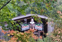
A little way past the wetland area, you’ll reach the Littell Bridge. This overpass, completed in 2023, provides a safe way for pedestrians to cross the busy state highway. The bridge’s cool design and “Willapa Hills Trail” gateway sign also make it a great place for a photo op. If it’s a clear day, you might even catch a glimpse of Mount Rainier in the distance. You can keep going past the overpass for a longer trek or head back to the trailhead for a total walking distance of about 2.4 miles.

Adna to Bridge 5: Heading west from the Adna trailhead, you’ll cross Bunker Creek Road, where the trail begins to meander through picturesque farmlands. Keep a lookout for sheep or cattle grazing in the fields nearby. Thick blackberry brambles line the trail here, making this a popular spot for berry picking in late summer. Bring a pail or munch as you walk.
At about one mile, you’ll come to Bridge 5, an impressive old railroad trestle spanning the Chehalis River. Stop to admire the view of the river and snap a few photos. If you’re lucky, you might see a bald eagle flying overhead. The bridge is a great place to turn around, giving you a total roundtrip distance of just under two miles. The paved portion of the trail ends here.

If you want a longer walk, continue on the gravel pathway past Spooner Road to Bridge 6. This newer steel bridge, constructed in 2015, offers another stunning view of the Chehalis River bordered by forest and farmland. The original bridge was destroyed during the December 2007 flood. Turn around at the bridge for a total roundtrip of almost five miles.
Both of these trail sections include long stretches in full sun with little shade, so remember to bring water, a hat and sunscreen for those hot summer days. You can also beat the heat–and the crowds–by walking early in the morning or later in the evening.
Before returning to the highway, stop by the Adna Grocery Store on Bunker Creek Road. Take a look inside this fun little country store, which features ice cream bars, Adna High School merch, local honey and Uncle Jim’s popular smoked sausages. You can also grab a burger, shake and fries at their cafe just around the corner.

Rose County Park
Distance: 0.4 miles
Difficulty: Easy
Location: 263 Penning Road, 2 miles west of Adna
Open: Open weekends, Memorial Day through Labor Day
Restrooms: Yes. Open seasonally
Accessible: No
Pets: Leashed dogs are welcome. Please pick up after your pet.
Parking: There is ample free parking and no pass is required. The park is located partway up Penning Road on the left, just before the forested area ends. Make a sharp left turn for the park entrance. *Currently, there is no park sign posted on Penning Road, but you can plug in the address and find it using GPS.
Trail Summary: Tucked away on a hillside in Adna, Rose Park is a hidden gem. The quiet 21-acre county park features picnic tables, a covered shelter, a playground, horseshoe pits and a lovely half-mile loop trail through the woods.
The Rose Park Trail begins at the far end of the parking lot next to the play structure. Once you cross the little wooden bridge, you’ll come to a fork where you can choose to walk the loop clockwise or counterclockwise.
The peaceful path winds through a wooded hillside of tall firs with carpets of fern underneath. Along the way, you’ll pass under archways of viney maple with dappled sunlight filtering through. Breathe in the scent of fir as you tread along the quiet trail and listen to the trees whispering in the breeze.
For those who enjoy a workout, the trail also includes a workout circuit with different exercise stations along the way.
The Rose Park Trail is almost entirely shaded, making this the perfect place to explore on a hot summer afternoon. Although the park can get a little busy on summer weekends, you’ll most likely have the place to yourself in the mornings or evenings. Remember to bring insect repellent, as the mosquitoes can be pretty thick at times.
NOTE: Rose Park receives little maintenance. Don’t let that deter you. Although the trail signs and exercise equipment show signs of age, the trail itself is clear and a nice option for those seeking a quiet walk in the woods.

Rainbow Falls State Park Trails
Distance: 0.5-3.0 miles RT
Difficulty: Easy with some incline
Location: 16 miles west of I-5, along Highway 6
Open: Open year-round
Restrooms: No
Accessible: No
Pets: Leashed dogs are welcome. Please pick up after your pet.
Parking: There is a large pullout area next to the river, as well as street parking next to the wooden rail fence on the trail side. No pass is required unless you visit the park itself. Then you would need a Discover Pass. *If parking next to the river, be careful crossing the highway to the trailhead.
Trail Summary: This forested trail system on the hillside across from the Chehalis River is one of West Lewis County’s best-kept secrets. The beauty of this hike is that you can choose your own adventure. Made up of a series of loop trails, named Hemlock, Deer, Oxalis, Salal and Woodpecker, the paths intersect at different points, giving you lots of options. In the center is an unnamed old gravel road that leads downhill to the trailhead. To experience the most scenic parts of the trail, we recommend doing the outside loop.

Heading east on the Oxalis Loop and then up the Hemlock Trail, you’ll encounter lush green foliage, moss-draped trees and some of Washington’s beautiful native plants. This part of the trail is especially magical in the springtime when seasonal creeks and tiny waterfalls come alive, their shores bursting with Pacific trillium, bleeding hearts and maidenhair ferns. Be sure to bring your camera for close-up shots of these natural beauties.
At the top of the hillside, the Hemlock Trail connects to the Deer Trail, taking you into the western half of the trail system. Here, the path meanders under a canopy of enormous old-growth trees. Take a moment to gaze up at the awe-inspiring Douglas firs, western hemlocks and western red cedars. These giant trees are remnants of the old-growth forests that once grew all over this region. Stay on the Deer Trail as it heads downhill–it will loop you right back to the start.

There is no posted trail map, so we recommend you print out or take a screenshot of this Rainbow Falls State Park map to help you navigate the trail system.
After you’re done hiking, cross the state highway for a close-up view of the scenic Chehalis River and Rainbow Falls, the lovely cascades that give the park its name.
NOTE: Although the trails are part of Rainbow Falls State Park, you cannot access them from the campground or day use area. The bridge that once connected the campground to the trails washed out in the big flood of 2007. To avoid driving to the campground on Leudinghaus Road by accident, make sure to enter “Rainbow Falls Trail” in your GPS map. The trailhead is along the highway between mile markers 36 and 35.

Willapa Hills Trail – Doty to Owl & Olive
Distance: 2.6 miles RT
Difficulty: Easy
Location: Stevens Road, Doty
Open: Open year-round
Restrooms: No
Accessible: Yes. The path is gravel and flat.
Pets: Leashed dogs and horses are welcome. Please pick up after your pet.
Parking: The closest parking to the scenic section between Doty and Owl & Olive is next to the trail access in Doty at the beginning of Stevens Road. Starting from here gives you about a 2.5-mile round trip. There is space for two vehicles to park in the gravel pullouts. Be careful to park completely off the road and do not block the trail entrance.
If you’d prefer a longer walk, you can park next to the trail access along Doty-Dryad Road for a 4-mile round trip. You can also start this section from the opposite direction, heading east on the trail towards Stevens Road. Park just north of Pe Ell in the gravel area at the intersection of Highway 6 and Mauerman Rd N for a 6.6-mile round trip. Jones Creek Brewing on Beam Road welcomes Willapa Hills Trail users to park at their business. Starting from here would give you just over a 7-mile round trip.
Trail Summary: From Stevens Road, head west. This beautiful section of the Willapa Hills Trail, between Doty and Owl & Olive, follows the Chehalis River as it turns south toward Pe Ell.
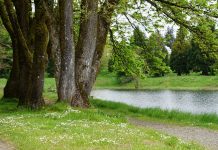
This is one of the most picturesque river sections of the trail! Here, the Chehalis meanders past a rolling meadow to the west with the Doty Hills just beyond. Tall evergreen firs and leafy maples dot the shoreline, reflecting shades of green on the water’s glassy surface.
After one mile, you’ll see a historic barn across a big field. This is Owl & Olive, a special event and wedding venue. Turn around here for a total round trip of 2.6 miles.
This shorter section is partly shady. If you start from one of the other parking spots, prepare for long stretches in full sun with little shade. Remember to bring water, a hat and sunscreen if it’s hot out. You can also beat the heat–and the crowds–by walking early in the morning or later in the evening.
To top off your walking adventure, we highly recommend a stop by the Doty General Store at the end of Stevens Road. This historic country store is a great place to grab a refreshing drink or waffle cone before heading home.

Willapa Hills Trail – Pe Ell to McCormick
Distance: 4 miles RT
Difficulty: Easy
Location: E 4th Ave., Pe Ell
Open: Open year-round
Restrooms: Yes
Accessible: Yes. The path is gravel and flat.
Pets: Leashed dogs and horses are welcome. Please pick up after your pet.
Parking: A Discover Pass is required to park at the Pe Ell Trailhead. You can also park for free along the street near the trailhead entrance.
Trail Summary: The Pe Ell trailhead sits on the same site as the old Pe Ell train depot. It’s hard to imagine now, but at the turn of the century, this quiet, grassy picnic area was the hub of the once booming timber town. Hidden beneath the tall trees to the north of the parking area is the old mill pond. It is the last remnant of the Yeoman Lumber Mill, Pe Ell’s first mill that was built here over a hundred years ago.
From the trailhead, head west. As you leave the Town of Pe Ell, you’ll cross a small bridge over Stowe Creek and wander past a few rural residences. To your right, notice the historic Forest Lawn cemetery, founded in 1898.
At about one mile, you’ll reach Bridge 23 over the Chehalis River. Rising 76 feet above the river, this is the tallest bridge on the trail and one of the most recently renovated. Perfect for a photo op! After snapping a picture, you can turn around for a 1.6-mile round trip or keep going for a longer walk.
Continuing beyond the bridge, you’ll pass through picturesque farmland with rolling hills bordered by evergreen forests. In the spring and early summer, you can sometimes see baby calves grazing in the fields with their mothers.
After about 1.5 miles, you’ll enter a natural tunnel of towering maples and firs. Their leafy canopy casts a cool, dappled shade, a welcome relief from the summer sun. Here, Rock Creek winds gently along the trail, murmuring quietly. In the fall, golden and amber leaves carpet the path next to the creek, making this one of the prettiest spots along the trail.
Turn around where the trail meets Remmen Road. This location is near what was once the booming mill town of McCormick. (You can read more about this ghost town at the Pe Ell Veterans Memorial Park on Main Street.) Head back the same way you came for a total walking distance of about 4 miles. This section includes stretches of both sun and shade, so bring water, a hat and sunscreen for those hot summer days.
After your walk, enjoy a picnic at the trailhead or stop by Evey’s Cafe in Pe Ell for burgers, fries and a milkshake. Jones Creek Brewing, located a little over a mile east of Pe Ell, is open on the weekends and welcomes trail users to stop by for their craft beer and bar snacks.
The next time you feel like taking a walk, head west on Highway 6 and give one of these scenic trails a try. You never know what treasures you’ll spot in the wild when you keep your eyes and ears open!
What is your favorite trail in West Lewis County? Comment on our Facebook page and let us know!


