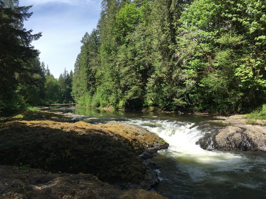
Late summer and early fall are great times to enjoy some of Lewis County’s scenic rivers and lakes. Whether it’s fishing from a boat in Riffe Lake, paddling a canoe down the Chehalis, swimming at Mayfield Lake, or dipping your toes in the Skookumchuck, our county offers many cool places to cool off. But did you ever wonder about how these familiar places got their names?
In 1923, Edmond Meany wondered just that. He set out to research the stories behind the names of Washington’s geographic places. His resulting book, “Origin of Washington Geographic Names,” shows just how remarkable the names of Washington’s waters can be! Meany noted that most of Washington’s places were named after people, Native peoples or Native words, or physical features. Other sites were named after animals, plants, or even other towns, states, or countries. See if you can figure out which category some of Lewis County’s waters were named for, and enjoy learning more about the history of these familiar places.
Chehalis River
The Chehalis River, which begins in the Willapa Hills above Pe Ell and flows into the Pacific at Grays Harbor, takes its name from the Lower Chehalis Tribe, who lived at the mouth of the river near Aberdeen and Westport. The word Chehalis means “shifting and shining sands,” and the Chehalis Tribe still calls themselves the “People of the Sands.” Early settlers applied the same name to the river and the Native peoples who lived at the upper end of the river, even though the tribe they called Upper Chehalis Indians—who lived in the hills and valleys of western Lewis County—were distinct from the ocean-oriented Lower Chehalis. Both tribes did, however, rely on the vital waterway for food, transportation and trade and built impressive cedar longhouses along its shores.
Early settlers in the Boistfort and Adna areas also used the river to transport goods to market. In western Lewis County today, people can still paddle portions of the upper Chehalis River, camp along its shores at Rainbow Falls State Park, picnic near the water at Lintott/Alexander Park, walk and bike along its scenic shores on the Willapa Hills Trail or birdwatch along the Chehalis River Discovery Trail.
Skookumchuck River
Skookumchuck is a Chinook Jargon term that literally means “strong water” or “rapids.” (Skookum means “strong,” and chuck means “water.”) This 45-mile-long river flows westward from its origins in the Huckleberry Mountains southwest of Mount Rainier into the Chehalis River in present-day Centralia. For years, the Upper Chehalis Indians camped along its shores in the summer.
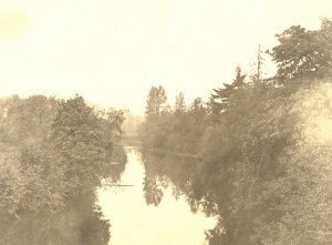
In the mid-1800s, Centralia founder George Washington settled on land near one of those Indian camps and built his homestead where the Skookumchuck joins the Chehalis River, near present-day Exit 82 on Interstate 5. On hot summer days, Shaefer County Park in North Centralia and Riverside Park in Centralia are popular spots to gather for picnics, tube down the gentle rapids or just enjoy the quiet beauty of the Skookumchuck.
Tilton River
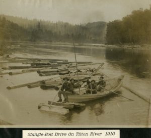
The scenic Tilton River in East Lewis County was named after the first surveyor general of Washington Territory. A tributary of the Cowlitz River, it begins in the foothills of the Cascade Range southwest of Mount Rainier and flows into Mayfield Lake.
The Upper Cowlitz or Taidnapam peoples camped along its shores. Meandering through picturesque hills and forests between Morton and Mossyrock, the Tilton River is one of Lewis County’s hidden treasures, featuring excellent fishing and rapids for outdoor enthusiasts.
Carlisle Lake
Carlisle Lake in Onalaska was named after wealthy businessman William Carlisle who established an impressive timber mill in the area. The lake, known initially as Onalaska Mill Pond, was used as the holding pond for the new Carlisle Lumber Company, which included a planer, dry kiln and big sawmill.
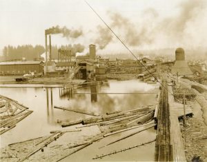
Built in the early 1900s, the sawmill was considered the largest inland mill in the world at the time. Today, the iconic smokestack is the only structure that remains and provides a historical backdrop to the popular recreational and fishing lake. Owned and managed by Onalaska Alliance, the lake and surrounding park also offer opportunities for local students to study aquaculture and learn about native flora and fauna.
Packwood Lake
Early pioneer and explorer William Packwood was credited with discovering the pristine mountain lake in eastern Lewis County that now bears his name. But the Taidnapam people, who camped along its shores and fished its waters for countless generations, have been visiting the lake long before settlers came.
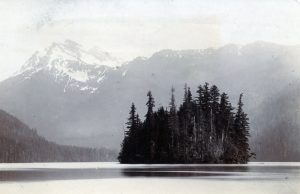
Located in the Gifford Pinchot National Forest near the town of Packwood, the two-mile-long picturesque lake still draws people to its shores and is a popular destination for hikers and campers.
Mineral Lake
Aptly named for the rich minerals discovered near its shores, this northeastern Lewis County lake was once the site of coal, arsenic and cinnabar mines. Early in its history, Mineral Lake was also used as a holding pond for a nearby sawmill and stored millions of board feet of cedar logs.
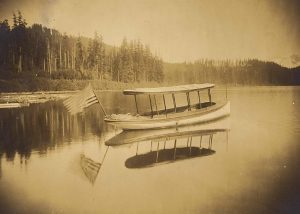
Today, Mineral Lake attracts visitors to its shores for fishing and recreation and boasts one of the most stunning views of Mount Rainier from its shores.
Riffe Lake
Scenic Riffe Lake, one of Lewis County’s largest lakes, is manmade. Created in 1969 with the completion of the Mossyrock Dam, the 13-mile-long reservoir that stretches from Mossyrock east was given the name Davisson Lake after the Tacoma Utilities director. However, locals were disappointed with the name as it did not have any strong connections to Lewis County.
Working together, they submitted petitions and resolutions to have the name changed. They wanted to name the new lake after early pioneer Floyd Riffe who was instrumental in bringing many settlers to Lewis County from West Virginia and Kentucky. Their efforts were successful. The name was officially changed to Riffe Lake in 1976 by the State Board of Geographic Names.
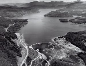
Underneath its deep blue waters, Riffe Lake is home to the ghost town of Kosmos, which was abandoned and completely submerged when the lake was created. Today, the lake teems with smallmouth bass, landlocked coho, Chinook salmon and trout. With a year-round open fishing season, it is a popular destination for those wanting to fish. Tacoma Power’s Mossyrock Park on its western shore and Taidnapam Park on its eastern end offer recreational camping and day-use areas that are enjoyed by swimmers and boaters alike.
Mayfield Lake
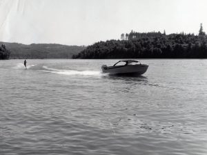
Also manmade, Mayfield Lake near Mossyrock was named after Henry Clay Mayfield, a newspaperman who established the community of Mayfield in 1891. The reservoir was formed in 1962 with the creation of the Mayfield Dam on the Cowlitz River.
A popular destination for camping, swimming, boating and fishing, the lake features two public parks — Ike Kinswa State Park and Mayfield Lake Park — along with a private resort that attracts locals and visitors alike during the hot days of summer.
Most of these familiar places were named after people who greatly impacted our county. This list, however, by no means covers all the scenic waterways and lakes in Lewis County. Stay tuned for more history behind these water names in “The Story of Lewis County Waters — Part 2.” In the meantime, share your favorite place to cool off in Lewis County by commenting on our Facebook post!


